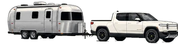
The big crossing: over the Continental Divide and through Glenwood Canyon, down to Grand Junction for an overnight power nap at the charger before the dawn run into Utah.
295.4miles
~7 with the passes + chargingdrive hours
Idaho Springs RANfirst charge
Power nap at the Grand Junction RAN tonight
Weather: Mountain snow possible on the passes even in June (check CDOT), then high-desert heat down to Grand Junction
The day's numbers, route, photos, and video below↓
Day 25The rig below the Argo Gold Mill, Idaho Springs' red landmark climbing the hillside.
The day, by the numbers
Miles driven295.4mi
Cost per mile10.2¢ / mi charging
Towing efficiency1.21mi / kWh295.4 mi · 245 kWh
Energy 245 kWh
used · 268 kWh charged across 3 sessions
Wind14mph WMostly headwind
Temperature 84 °F56 – 84°F range
Peak elevation11,158ft↑ 13,700 ft↓ 16,450 ft
Avg speed48mph · 6 hr moving
Map loads with JavaScript. Each day page also lists every stop in text below.
Photographs
Day 25 in pictures
1 / 10Rolling west out of Denver with the Airstream in tow, glass roof to the mountains and Mission's hammock in back.
Free RAN charge to 90% before the climb. Going west, this is the pre-tunnel top-up. Rolled past Eric's Asian Cafe in town on the way through, too good a name-match for an Eric to let slide.
↑Headwind on this leg14 mph from the W▲Climbs this leg+3,850 ft
11,158 ft, highest interstate tunnel in the world. Don't stop in or near the tunnel. Photo from Loveland Pass overlook before, or the runaway-truck ramps just after.
↑Headwind on this leg14 mph from the W▼Descends this leg−4,200 ft
Charged here at 6,492 ft instead of Glenwood Springs, down off the divide in the Eagle River valley. The towing climb from Idaho Springs over the passes ran just 1.10 mi/kWh, so we topped up earlier than planned.
↑Headwind on this leg14 mph from the W▲Climbs this leg+1,200 ft
I-70 threads the canyon for ~12 miles, so the scenic drive IS the route, no detour and zero extra miles. To get out and walk it, pull off at the Grizzly Creek Rest Area (Exit 121), trailer-friendly with Colorado River access and the paved canyon rec path. Skip Hanging Lake (Exit 125): timed reservation plus shuttle, no trailer parking.
↑Headwind on this leg14 mph from the W▼Descends this leg−3,100 ft
Free RAN top-up off I-70 (8:13 PM, 121 kWh). Gypsum to Moab is too far on one charge towing, so this is the bridge charge. We parked here for the night rather than push the last 110 mi into the red rock after dark.
Caught a power nap right at the charger, then splashed the pack back to nearly 100 percent at 2:31 AM (10 kWh) to have full range for the dawn run to the Windows.
Day 25Rolling west out of Denver with the Airstream in tow, glass roof to the mountains and Mission's hammock in back.
Towing segments this day
The charge-to-charge data, leg by leg.
Every towing leg logged today off the Rivian dashboard, with its elevation
profile. Open one for the full per-segment data: efficiency, energy, grade,
wind, temperature, and battery state of charge.
Free for this trip. Replaces the Frisco Supercharger as the pre-tunnel charge. Going west you climb to the Eisenhower Tunnel from here, so charge to 90% before the ascent. Confirm the exact site in Rivian nav.
Tesla
Gypsum Tesla Supercharger
Paid stop down off the divide (charged here, $35.15 for 95 kWh) instead of Glenwood Springs, because the climb over the passes ran the pack down faster than planned.
RAN charge Rivian Adventure Network
Grand Junction RAN
Free for this trip. The bridge charge before the last push into Utah, Gypsum to Moab is too far on one charge towing.
Social signal
Follow Day 25 beyond the page
Photos, short video, charge-stop notes, and the little roadside details usually land on social first. The full route stays archived here.
6 receipts, app screens, pedestal displays, and Rivian dashboard readouts. Click through with the arrows; tap the tile to view full size.
On the climb at 7,516 ft, Trip A 4,832.9 mi trip-to-date. The towing grade pushed the motors to 158 F.Trip B 69.3 mi at Idaho Springs, the towing out of Golden so far.Down off the divide at Gypsum, Trip A 4,938.9 mi. The Idaho Springs to Gypsum leg ran 106 mi at just 1.10 mi/kWh, the altitude tax.Trip B reads 175.4 mi, the whole day from Golden, the reset got skipped at Idaho Springs, so the Gypsum leg is the 106 mi above the 69.3.Down off the Rockies at the Grand Junction RAN, Trip A 5,058.7 mi. The Glenwood Canyon descent recovered the day's average to 1.30 mi/kWh.Trip B 119.8 mi, the Gypsum to Grand Junction leg. Reset clean this time, so it matches the leg exactly.